Ellipsoidal, orthometric and geoid height 101
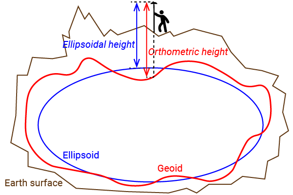

Many customers get confused with the different heights (altitude) reported by their GNSS receiver.
In this post we will show the concept of each one with plain words (we apologize to all surveyors and scientists that read this post).
Ellipsoidal height:
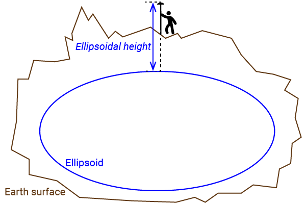
Planet earth shape is simplified as a rugby ball (ellipsoid).
Ellipsoidal height is the vertical distance between the GNSS antenna and the surface of the rugby ball.
Advantages: the ellipsoid model is really simple, many GNSS receivers use the same model.
Disadvantages: ellipsoidal height can have huge errors (>50m) compared to real height above mean sea level.
Orthometric height (also known as height above mean sea level):
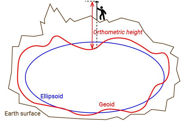
Planet earth shape at sea level is modelled with high detail (geoid).
Orthometric height is the vertical distance between the GNSS antenna and this high definition surface (geoid).
Advantages: the measured height represents the height above mean sea level.
Disadvantages: high definition models size is large, usually these models are not stored directly in the GNSS receiver but in the smartphone/computer applications.
Some of these high definition models are local (not global) to reduce their size.
Geoid height:
Is calculated as the height difference between the high definition model (geoid) and the rugby ball (ellipsoid) for a given location.
Geoid height = ellipsoidal height – orthometric height
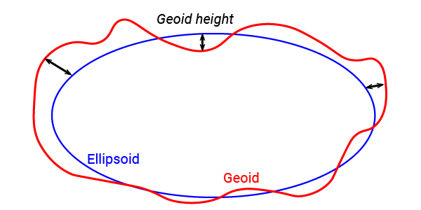
*Geoid height is sometimes referred as Geoid separation, Geoid undulation or Geoid deviation.
You can check this tutorial where we explain how to use a custom geoid for high quality orthometric height measurements with your Android device.
 and
and 


