and
and 
via Bluetooth
via USB-OTG (preferred method)
via Bluetooth
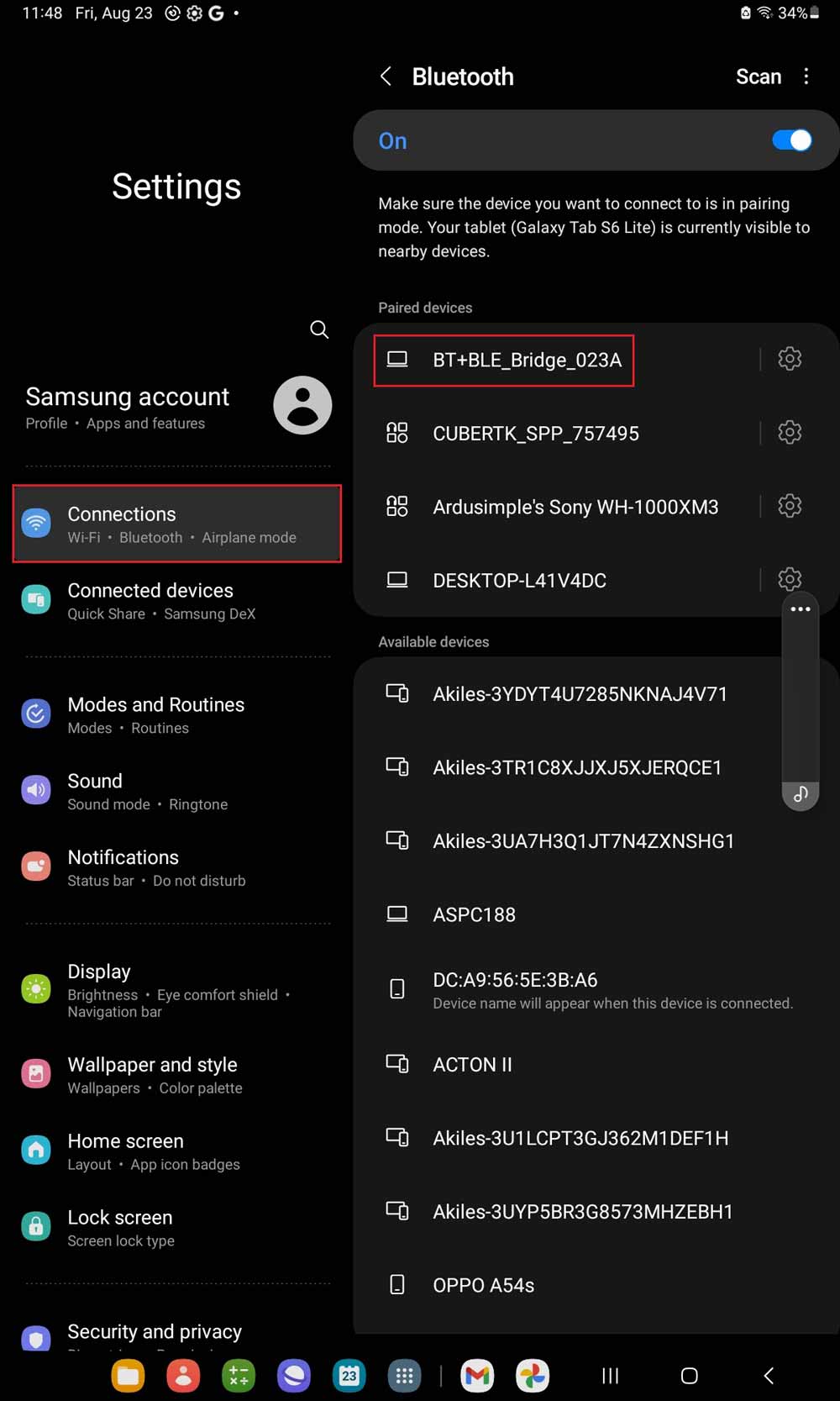
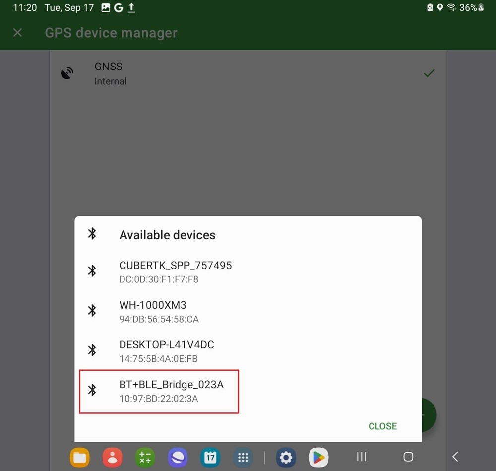
- Open your Android device, go to Bluetooth settings, search for your RTK kit which name will be BT+BLE_Bridge_XXXX. Tap pair.
Note: This only need to be done once.
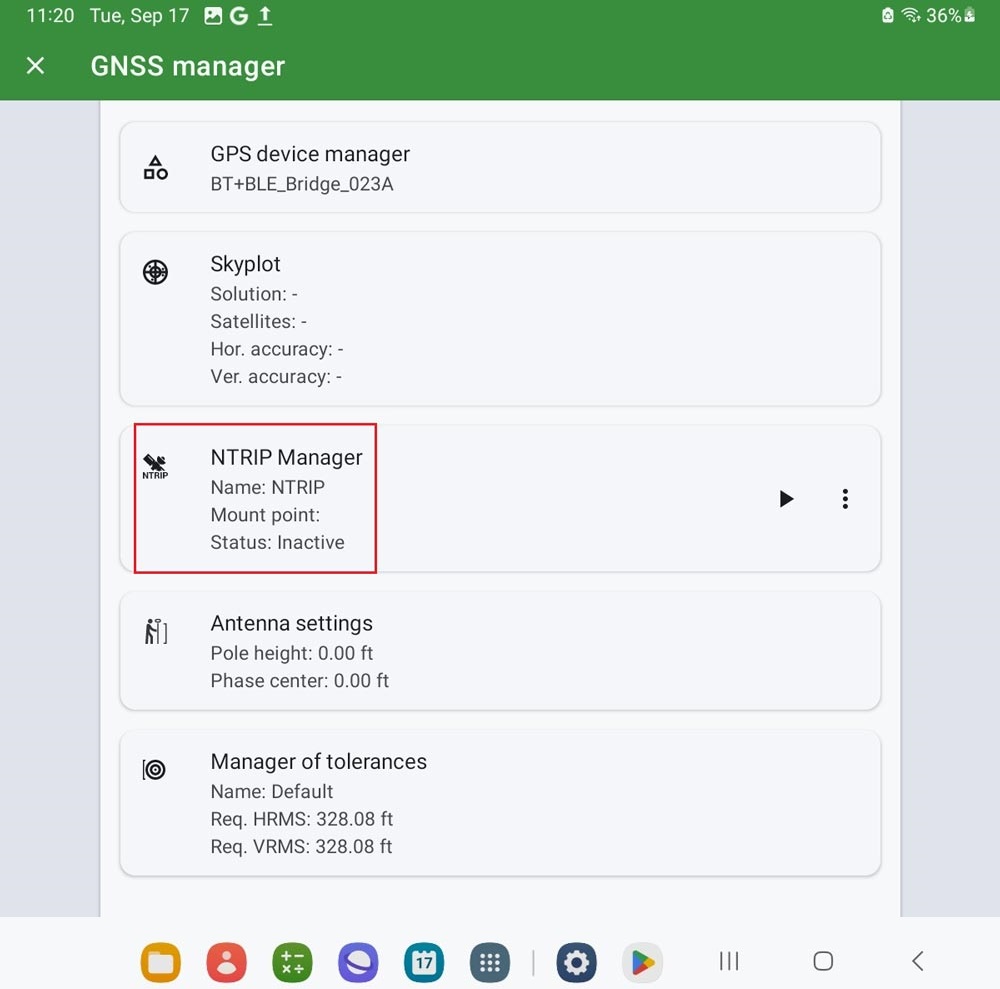
- Open Locus GIS. At menu, go to GNSS manager.
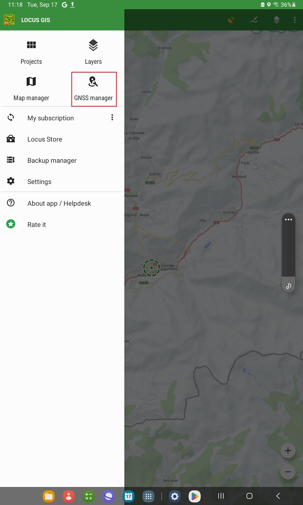
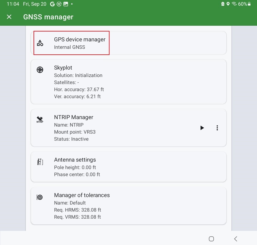
- Choose GPS device manager.
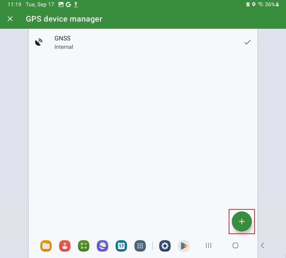
- Tap the + icon on right bottom corner.
- Select Bluetooth.
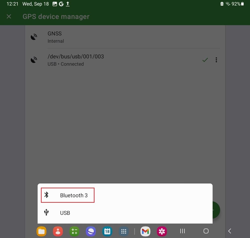
- Select the device you paired in step1.
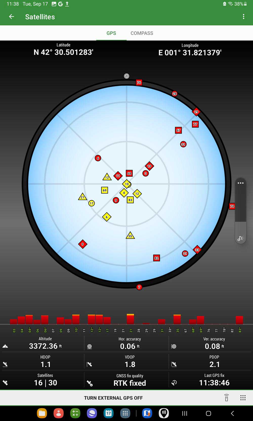
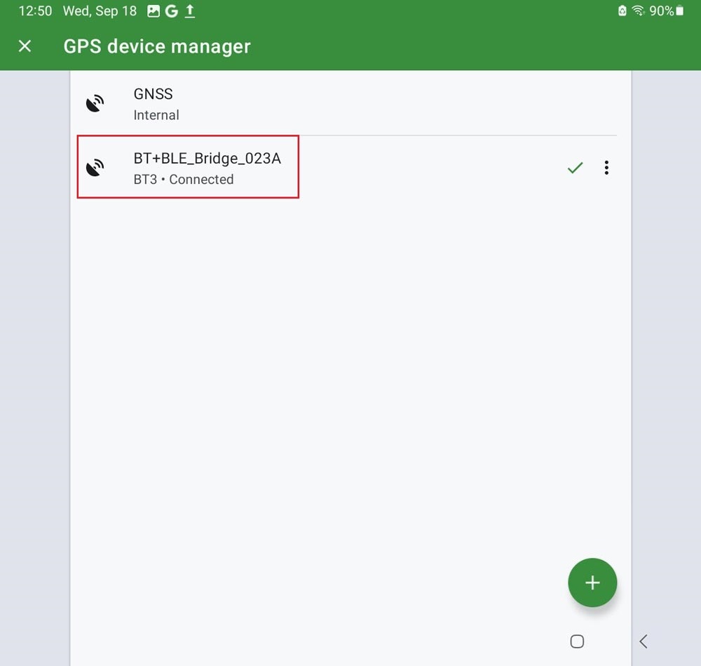
- It will show BT3 Connected.

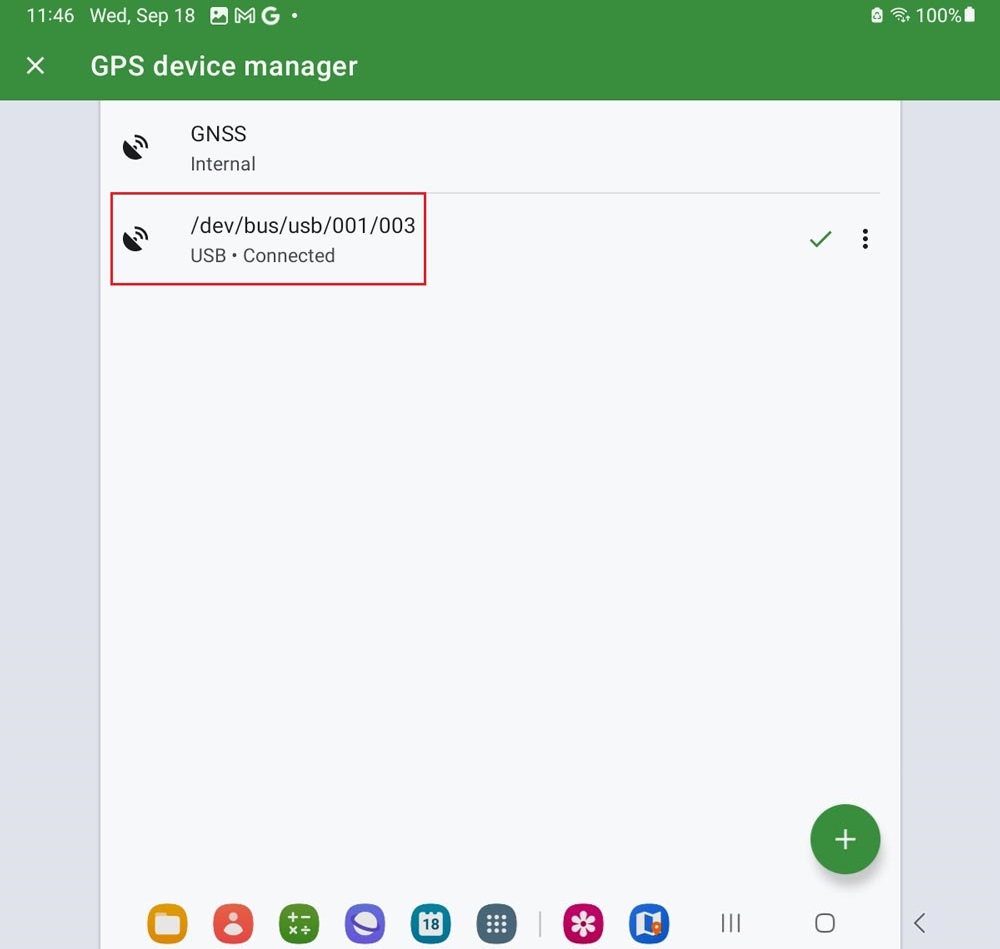
via USB-OTG (preferred method)
- Open Locus GIS. At menu, go to GNSS manager.
- Choose GPS device manager.
- Tap the + icon on right bottom corner.
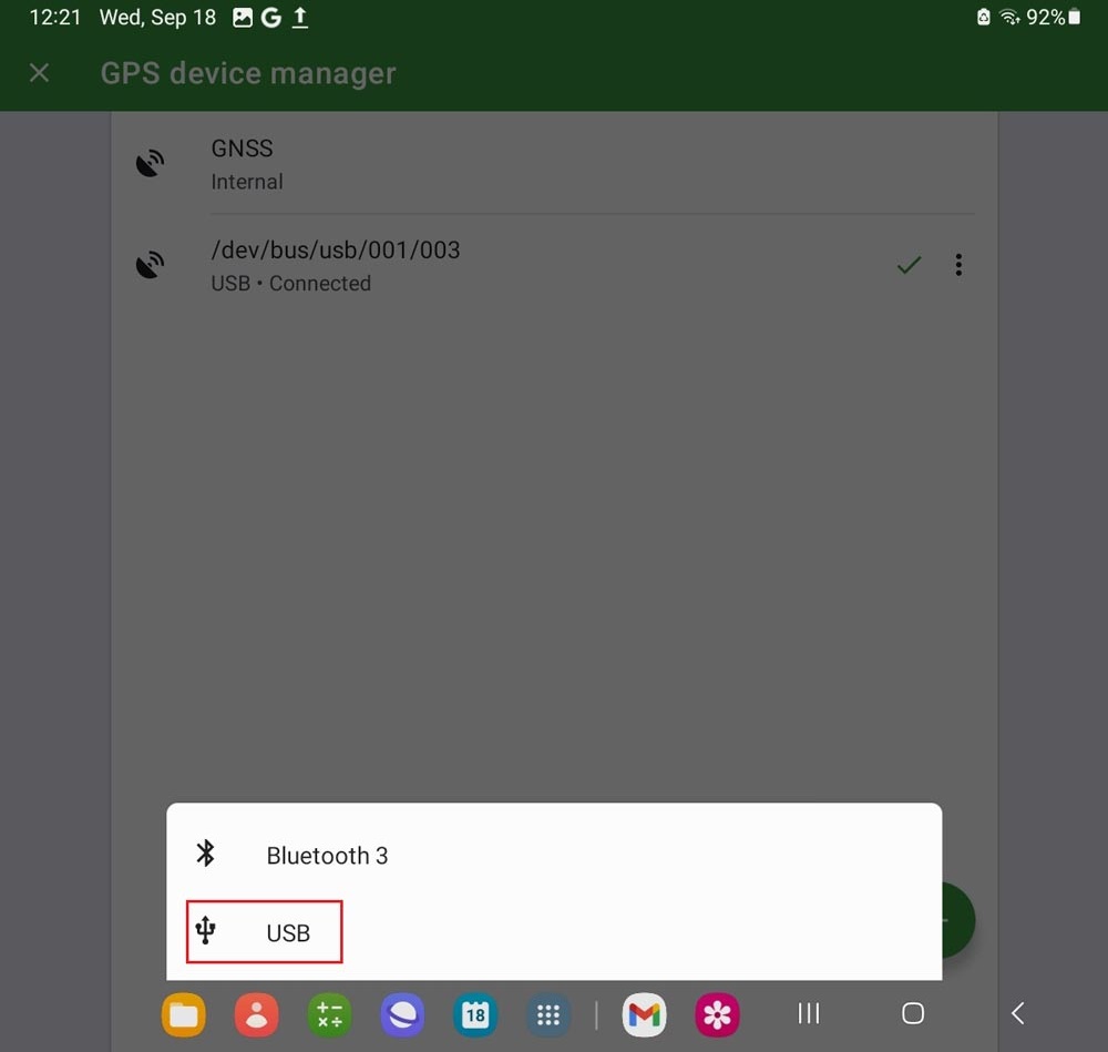
- Select USB.
- Select the USB UART.
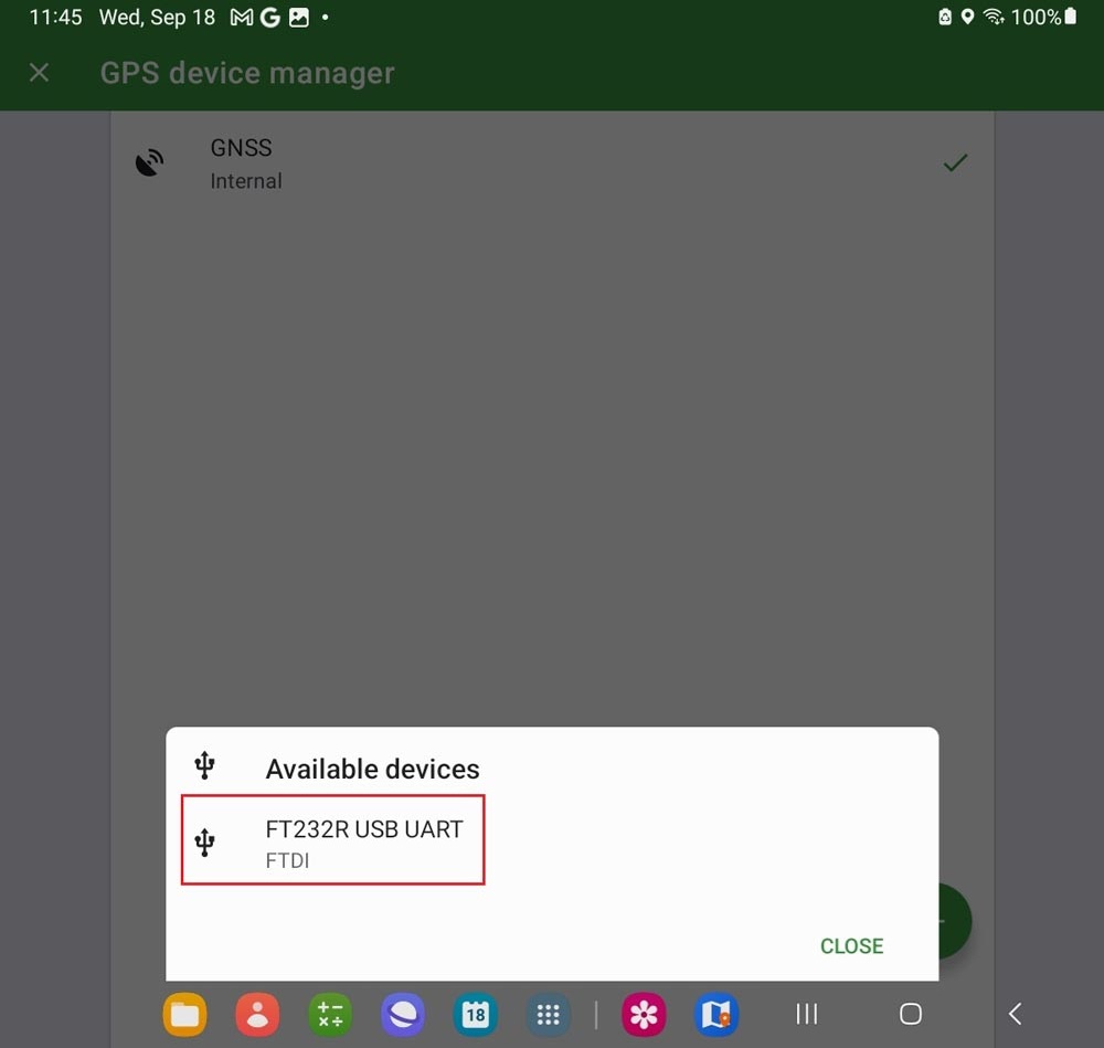
- It will show USB Connected.