How to connect ArduSimple kit to PointMan for mapping cables and tubes
PointMan is a paid software that captures, records, and displays the location of utilities and pipelines. It can be used with the ArduSimple Professional kit for mapping purposes. You may also want to add to this setup EM locate equipment like a cable or pipe locator to detect the location of buried cables and pipes.
PointMan also has a built-in NTRIP client that connects to correction services, enabling centimeter-level accuracy. If you’re unsure about NTRIP services in your area, we’ve prepared a list of services specific to your country.
Before beginning this tutorial, make sure that you have the credentials to connect to an NTRIP service.
In this tutorial, we will guide you on how to connect the ArduSimple RTK kit to PointMan to achieve precise, centimeter-level accuracy for your mapping projects.
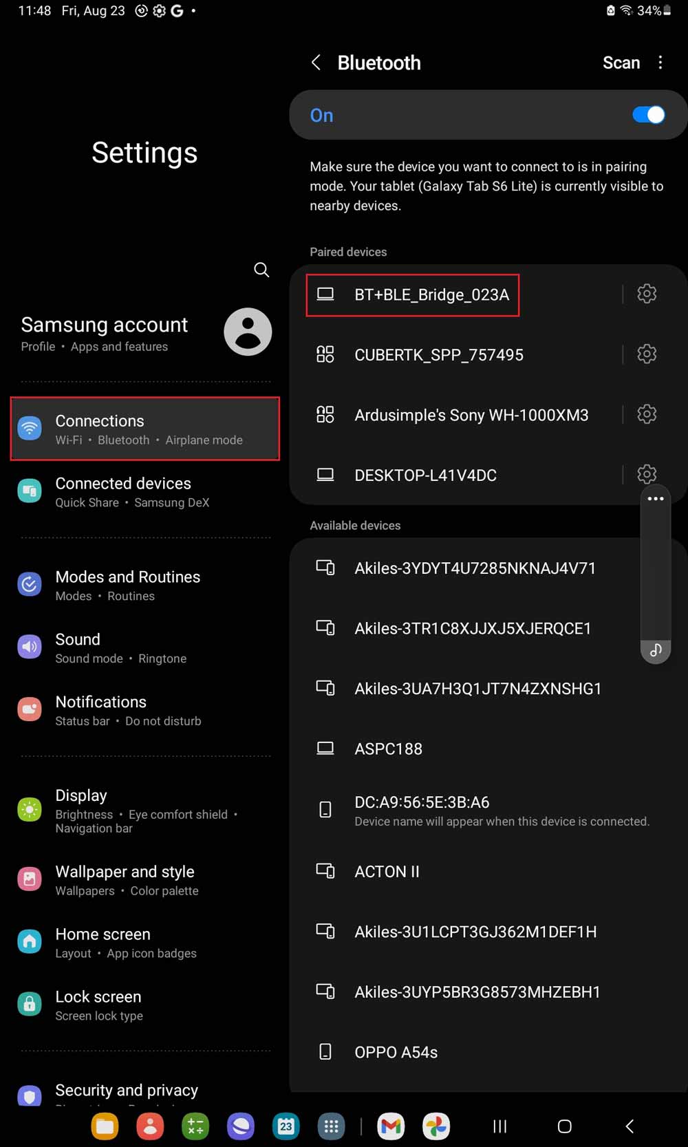
Connect your RTK kit to your phone via USB OTG cable. Open your Android device, go to Bluetooth settings, search for your RTK kit which name will be BT+BLE_Bridge_XXXX. Tap pair. Note: This only need to be done once.
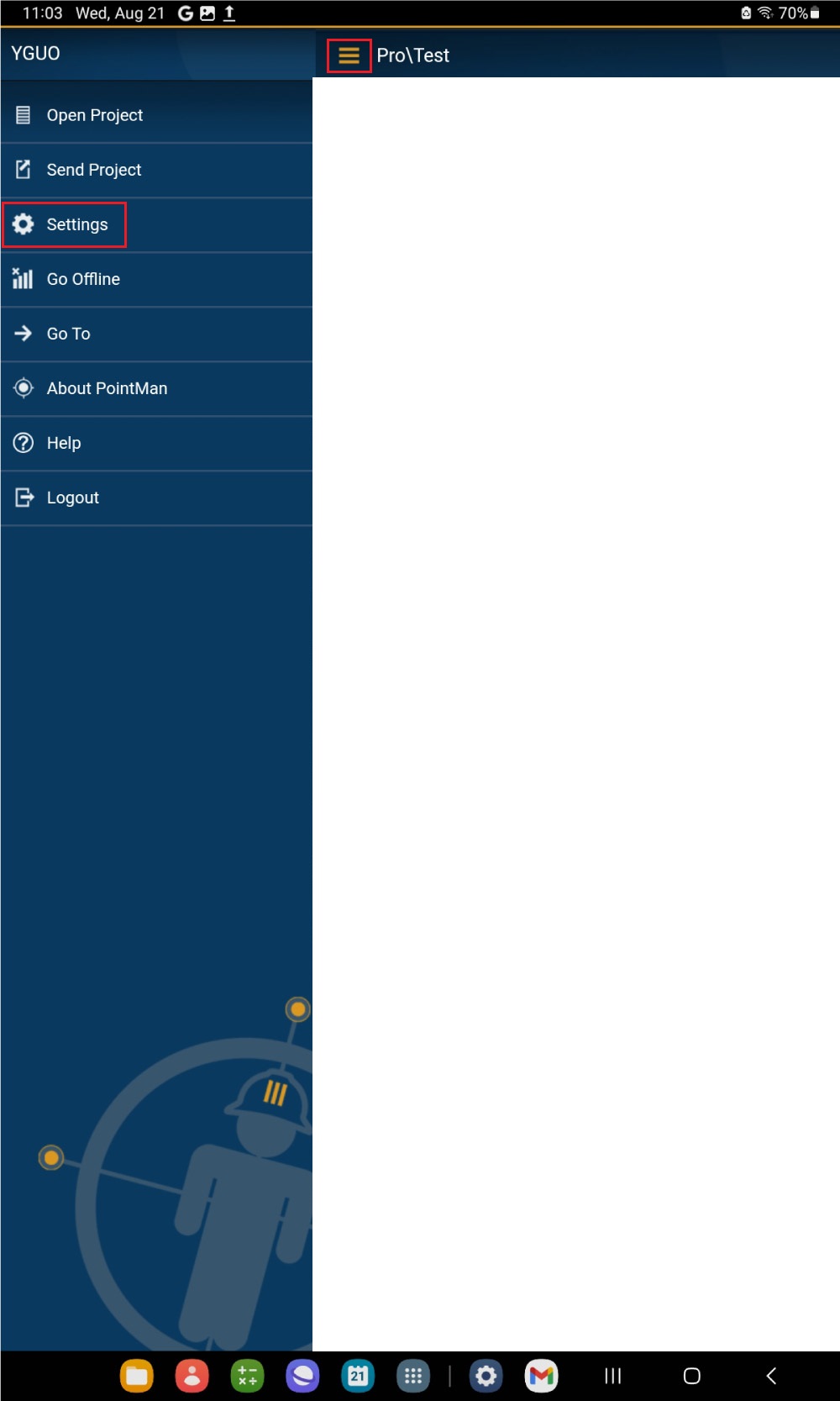
Open PointMan (Registration and subscription purchases are done on the PointMan website). At menu bar go to Settings.
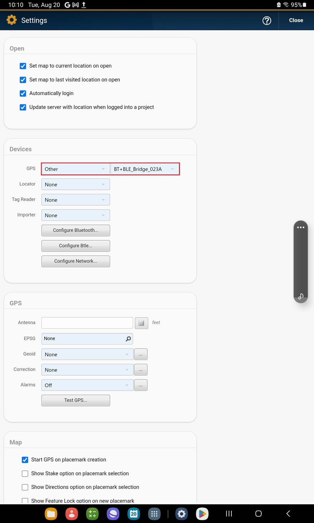
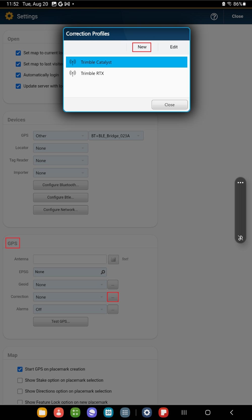
Go to Devices. At GPS choose Other. Select the device you paired in step1.
Go to GPS–>Corrections. Click New.
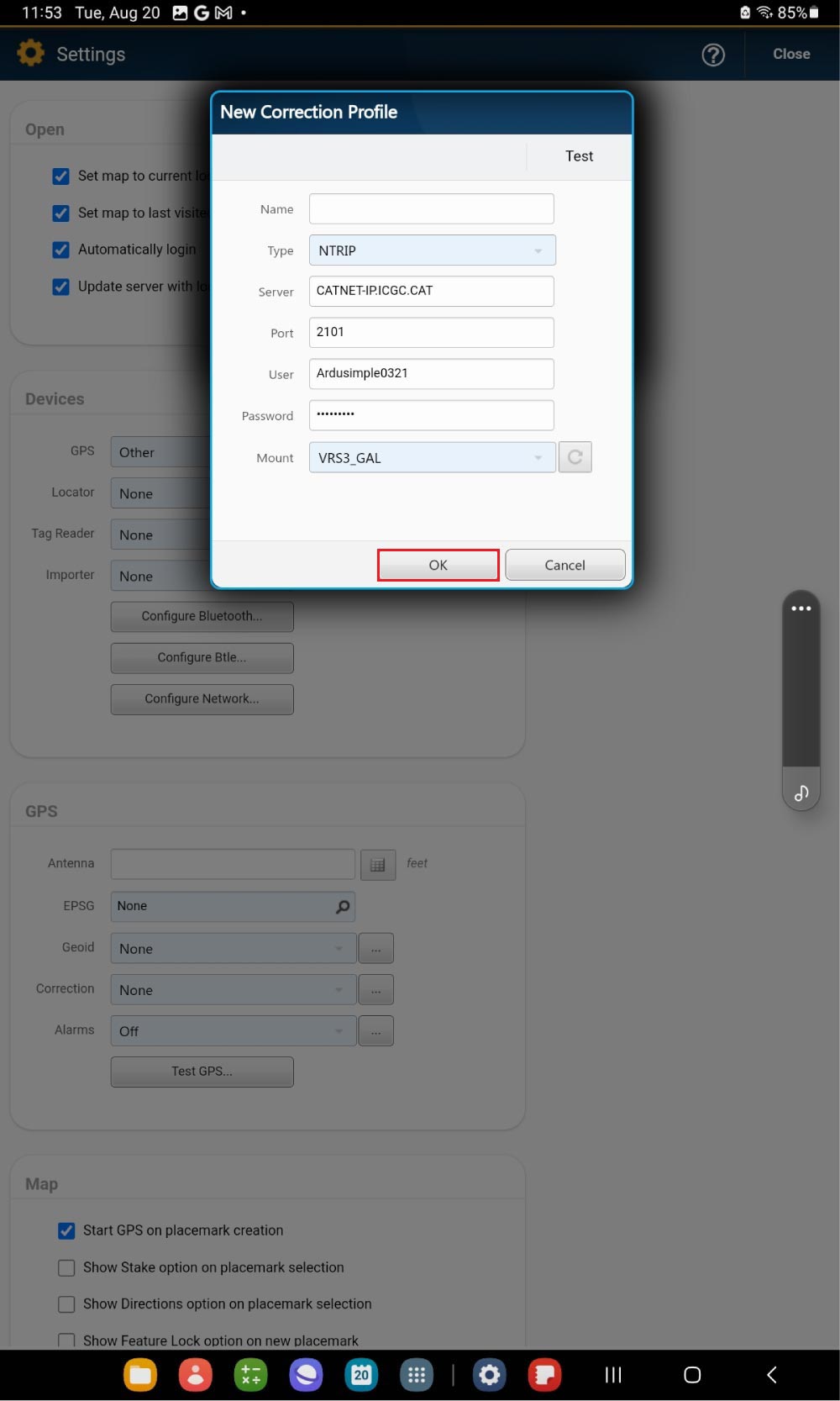
Enter a Name and set up your NTRIP Server, Port, User, Password and Mount point. Click OK.
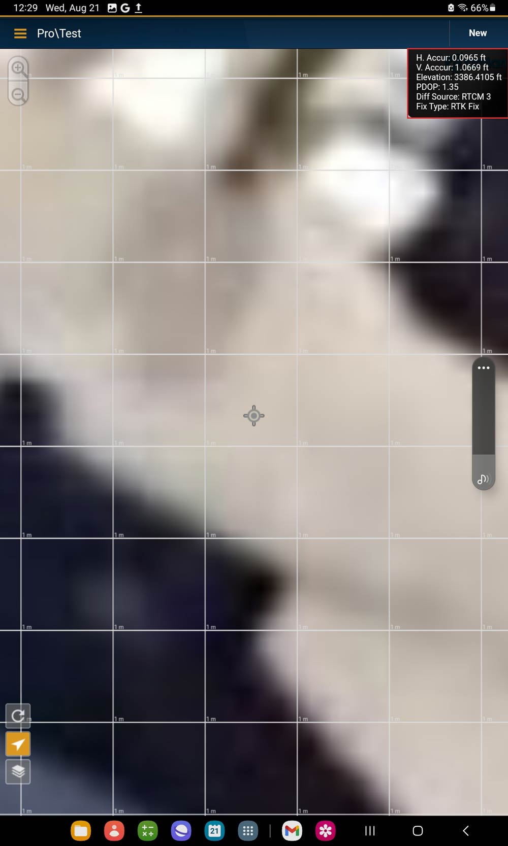
Go outside with your RTK kit. Place the antenna in complete open air with good view of the sky for testing the functionality.
Tap the Navigation icon on left cornet to connect the receiver. On the right corner you will see the location information. With NTRIP correction service connected, you will see the Fix Type is RTK Float or Fix.
Now you can map cables and pipes with centimeter-level precision. For detecting buried utilities, you can also connect your preferred locator.
If you want to do this tutorial, we have all the products in stock and ready to be shipped:
1. Our engineering team will contact you to solve any questions
2. We will keep you updated about promotions and new product releases
3.You will only hear from us when we have important news, we won’t spam your email

 and
and